LOS ANGELES WILDFIRES
THE MIS RESPONSE TO THE MAJOR FIRES WREAKING DESTRUCTION ACROSS LA
MIS LA WILDFIRES INTELLIGENCE BRIEFING
This video shows a snippet of a detailed webinar-style breakdown of MIS intelligence around the LA wildfires. Access the full video by clicking the button below, or keep scrolling to read more.
A DEVASTATING WILDFIRE EVENT
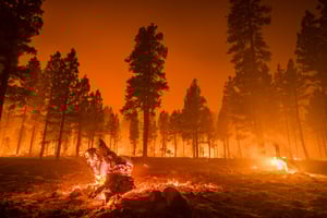
On 07 January 2025, several wildfires broke out in northern Los Angeles county, exploding in size due to swirling winds.
The Palisades, Eaton and Hurst fires gathered strength and spread rapidly across densely populated areas of LA, forcing around 150,000 people in the area to evacuate their homes.
With the Palisades and Eaton fires continuing to grow, having now burned approximately 23,000 and 14,000 acres respectively, smaller fires such as the Sunset, Lidia and Kenneth fires also began impacting local communities, with some 40,000 acres affected.
Tragically, this event has claimed the lives of at least 25 people in LA so far, whilst destroying thousands of structures and leaving many across the county without power.
Thankfully, it seems as if firefighters are beginning to contain most of the worst fires, with suburban areas in LA no longer under immediate threat.
THE MIS RESPONSE
The destructive nature of the LA wildfires meant that the MIS response threshold was met immediately, with the GEO report being released within 24 hours of the fires starting.
On 08 January, the team released the first Exposure Layer for this event on GEO, outlining initial Fire Perimeters and Observed Hotspots for the Palisades, Eaton and Hurst Fires.
As the wildfires continued to grow, there was an update to the Exposure Layer on 09 January, featuring the most up-to-date information for Fire Perimeters and Observed Hotspots.
With the team completing further data collection activities, on 10 January the first Claims Layer was added to the GEO report, outlining areas where damaged was confirmed with an attached damage assessment.
11 January saw another Exposure Layer update and the latest intelligence around Fire Perimeters and Observed Hotspots.
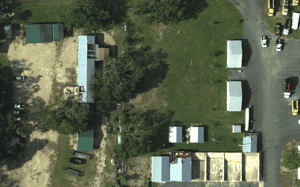
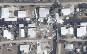
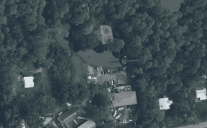
Following more assessments over the weekend, on 12 January the MIS team released a Claims Layer update, 40cm Satellite Imagery for areas affected by the Palisades, Eaton and Hurst Fires, as well as the first instance of Building Level Damage Assessments for this event.
The team added an additional 10,000 Building Level Damage Assessments on 13 January, as well as the latest information around Fire Perimeters and Observed Hotspots.
On 14 January, the GEO report was updated with a further 22,000 Building Level Damage Assessments, alongside new details concerning Fire Perimeters and Observed Hotspots.
The final Building Level Damage Assessments for this event were released on 15 January, featuring some additional ~9,000 properties. There were also updates to the Claims Grid, Fire Perimeters and Observed Hotspots.
On 15 and 16 January, the report was updated with the most up-to-date intelligence around Fire Perimeters and Observed Hotspots.
16 January also marks the End of Report for this event, so there will be no further updates from the MIS team unless the situation changes drastically.
RELEASE TIMELINE
- 16/01/2025
- 16/01/2025
- 15/01/2025
- 14/01/2025
- 13/01/2025
- 12/01/2025
- 11/01/2025
- 10/01/2025
- 09/01/2025
- 08/01/2025
End of Report
Update of Fire Perimeters and Observed Hotspots.
End of Report.

Exposure Layer 9
Update of Fire Perimeters and Observed Hotspots.

Final Building Level Damage Assessments Update
Update of Fire Perimeters, Observed Hotspots, Claims Grid and Building Level Damage Assessment

Building Level Damage Assessments Update
Update of Fire Perimeters, Observed Hotspots and Building Level Damage Assessment

Building Level Damage Assessments Update
Update of Fire Perimeters, Observed Hotspots and Building Level Damage Assessment

Claims Layer 2, 40cm Satellite Imagery and Building Level Damage Assessments
Update of Fire Perimeters, Observed Hotspots and 1km Claims Layer. 40cm Satellite Imagery of the Palisades, Eaton and Hurst fires and Building Level Damage Assessment added.

Exposure Layer 3
Update of Fire Perimeters and Observed Hotspots.

Claims Layer 1
Update of Fire Perimeters and Observed Hotspots. Release of 1km Claims Layer.

Exposure Layer 2
Update of Fire Perimeters and Observed Hotspots.

Exposure Layer
Release of Observed Hotspots and Fire Perimeters
.png?width=300&name=misgeo.io_(High%20Res%20Screenshot).png)
LOGIN TO GEO FOR ACCESS TO
~57,000 Building Level Damage Assessments
Claims Grid
40cm Satellite Imagery of Palisades, Eaton and Hurst Fires
Observed Hotspots
Fire Perimeters
EVENT GALLERY
-
AERIAL IMAGES
-
GROUND IMAGES
FULL REPORT AVAILABLE ON GEO
Don't have a access to GEO? Request a demo below or for immediate support, contact mail@mckenzeintelligence.com


