
Hurricane Ernesto
MIS RESPONSE TO THE THIRD HURRICANE OF THE 2024 ATLANTIC HURRICANE SEASON
THE LATEST HURRICANE
Tropical Storm Ernesto became the fifth named storm of the 2024 Atlantic hurricane season after it officially formed late on 12 August.
Ernesto brought heavy rainfall as it moved through the northeast Caribbean on 13 August, reaching the US and British Virgin Islands as well as Puerto Rico.
After moving over the North Atlantic as a Tropical Storm, as of 15 August Ernesto became a Category 1 hurricane, strengthened by warm sea temperatures and low wind shear.
On 17 August, Ernesto passed over Bermuda at Category 1 status, bringing high winds and heavy rainfall.
Ernesto is currently travelling over the open waters of the Atlantic as a Tropical Storm, where it is expected to pass near southeastern Newfoundland by 19 August.
THE MIS RESPONSE
The MIS team released the Pre-event Layer on GEO for Tropical Storm Ernesto on 13 August, which showed the Confirmed Track, Predicted Track, Predicted Arrival Times, and Cone of Uncertainty.
On 14, 15 and 16 August, the product on GEO was updated with new Confirmed Tracks, Predicted Tracks, Predicted Arrival Times, and a new Cone of Uncertainty.
After making landfall in Bermuda on 17 August, the MIS team added an Exposure Layer to GEO on 18 August, which featured an exposure grid for wind damage in Bermuda, as well as wind speeds.
There was also updated Confirmed Tracks, Predicted Tracks, Predicted Arrival Times, and a new Cone of Uncertainty.
RELEASE TIMELINE
- 18/08/2024
- 16/08/2024
- 15/08/2024
- 14/08/2024
- 13/08/2024
Pre-Event and Exposure Report
Wind 5km x 5km Exposure Grid, Track, Arrival times and Wind Speeds added. Pre Event Information added including updated predicted paths, arrival times and cone of uncertainty.
.png?width=597&height=550&name=image%20(28).png)
Pre-Event Report
Pre Event Information added including confirmed tracks, predicted tracks, predicted arrival times and cone of uncertainty
.png?width=877&height=612&name=image%20(27).png)
Pre-Event Report
Pre Event Information added including updated confirmed tracks, predicted tracks, arrival times and cone of uncertainty.
.png?width=981&height=625&name=image%20(26).png)
Pre-Event Report
Pre Event Information added including updated confirmed tracks, predicted tracks, arrival times and cone of uncertainty.
.png?width=1016&height=677&name=image%20(25).png)
Pre-Event Report
Pre Event Information added including confirmed tracks, predicted tracks, predicted arrival times and cone of uncertainty
.png?width=1022&height=753&name=image%20(24).png)
.png?width=300&name=misgeo.io_(High%20Res%20Screenshot).png)
LOGIN TO GEO FOR ACCESS TO
Confirmed Tracks
Predicted Tracks
Predicted Arrival Times
Cone of Uncertainty
EVENT GALLERY
-
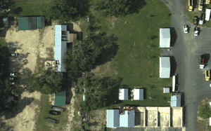
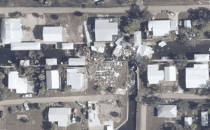
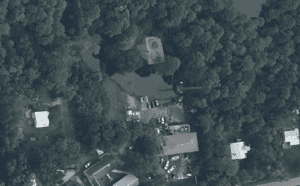
AERIAL IMAGES
-
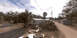
GROUND IMAGES



FULL REPORT AVAILABLE ON GEO
Don't have a access to GEO? Request a demo below or for immediate support, contact mail@mckenzeintelligence.com


