
Hurricane Ernesto
MIS RESPONSE TO THE THIRD HURRICANE OF THE 2024 ATLANTIC HURRICANE SEASON
- 18/08/2024
- 16/08/2024
- 15/08/2024
- 14/08/2024
- 13/08/2024
Pre-Event and Exposure Report
Wind 5km x 5km Exposure Grid, Track, Arrival times and Wind Speeds added. Pre Event Information added including updated predicted paths, arrival times and cone of uncertainty.
.png?width=597&height=550&name=image%20(28).png)
Pre-Event Report
Pre Event Information added including confirmed tracks, predicted tracks, predicted arrival times and cone of uncertainty
.png?width=877&height=612&name=image%20(27).png)
Pre-Event Report
Pre Event Information added including updated confirmed tracks, predicted tracks, arrival times and cone of uncertainty.
.png?width=981&height=625&name=image%20(26).png)
Pre-Event Report
Pre Event Information added including updated confirmed tracks, predicted tracks, arrival times and cone of uncertainty.
.png?width=1016&height=677&name=image%20(25).png)
Pre-Event Report
Pre Event Information added including confirmed tracks, predicted tracks, predicted arrival times and cone of uncertainty
.png?width=1022&height=753&name=image%20(24).png)
.png?width=300&name=misgeo.io_(High%20Res%20Screenshot).png)
LOGIN TO GEO FOR ACCESS TO
Confirmed Tracks
Predicted Tracks
Predicted Arrival Times
Cone of Uncertainty
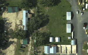
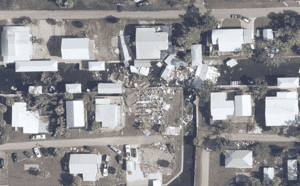
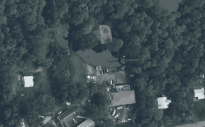
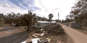
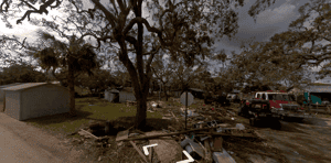
EVENT GALLERY
-
AERIAL IMAGES
-
GROUND IMAGES