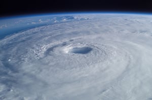
2024 Atlantic Hurricane Season Retrospective
Breaking down the 11th 'Extremely Active' Atlantic hurricane season and how MIS responded
A VERY BUSY YEAR IN THE BASIN
Build up to the 2024 Atlantic hurricane season was dominated by significant concerns that it was going to be one of the most active years in history.
After Colorado State University shared their highest ever early season prediction, other organisations like NOAA and the UK Met Office soon followed suit with similar forecasts of an exceptionally active year for hurricanes.
The season began in typically quiet fashion at the start of June, with Tropical Storm Alberto becoming the latest A-named storm in 10 years, forming on 19 June.
However, the end of the first month would make history, as Hurricane Beryl officially formed on 30 June, marking the earliest major hurricane in 58 years and the first time ever that a storm reached Category 4 status in June. After making landfall in Grenada, Beryl ripped through the Windward Islands, Jamaica and the Cayman Islands before hitting Texas as a Category 1 storm then quickly weakening.
Whilst this record-breaking start to the season seemed a precursor for worse to come, there wasn't another hurricane until Debby on 05 August, which hit Florida's Big Bend region as Category 1 storm to mark the first US landfall of the year.
Just over a week later, Hurricane Ernesto formed on 14 August, making landfall over Bermuda at Category 1 status.
On 11 September, the Category 2 Hurricane Francine made landfall in Louisiana, which was the fourth hurricane of the season and the second to make US landfall.
Although Hurricane Helene was generating widespread concern as it gathered strength across the Gulf of Mexico, on 23 September Hurricane John made landfall in Guerrero, Mexico as a Category 3 storm, close to where Hurricane Otis caused major devastation in 2023.
Helene would make landfall 3 days later on 26 September, hitting Florida's Big Bend region at Category 4 status, the first time a major hurricane had hit the US this year. The effects of Helene were felt across Florida and the Carolinas with widespread damage from wind and flooding, hitting roughly $89 billion in losses and becoming one of the deadliest hurricanes in history as it tragically claimed the lives of over 230 people.
With Florida still reeling from Helene, widespread panic was felt across the state as Hurricane Milton formed just two weeks later, reaching peak Category 5 intensity with Florida's Gulf Coast in its sights. Thankfully, fears that Milton could be one of the worst hurricane's on record were alleviated after it quickly weakened to Category 3 status before making landfall on 09 October near Siesta Key, Florida.
Though it was the second major hurricane to hit the Sunshine State in as many weeks, wind and flood-driven damage was not as severe as forecasted. However, Milton's abnormally large size meant that it still impacted a large portion of central Florida, totalling around $85 billion in damages.
As the season comes to a close with Milton as the last hurricane to hit the US, there has been another major hurricane since, Rafael, which became a Category 3 hurricane on 06 November and was the strongest November tropical cyclone in the Gulf of Mexico on record.
All in all, the 2024 Atlantic hurricane season has seen 18 named storms, 11 hurricanes and 5 major hurricanes. Though there wasn't as many named storms as anticipated by some, the number of hurricanes and major hurricanes fell very much in-line with the record-setting predictions of a highly active year.
This year, damages caused by Atlantic hurricanes have reached approximately $191 billion, driven largely by Helene and Milton, which makes 2024 the second-costliest Atlantic hurricane season of all time.
THE MIS RESPONSE
Of the 11 hurricanes to have formed in the 2024 Atlantic hurricane season, 7 of those reached the MIS response threshold and saw the release of subsequent event reports on GEO:
HURRICANE BERYL
- 30/06 - 16/07
- 14 GEO releases
- 50 unique data layers including Wind and Flood Claims Grids, Building Level Damage Assessments, 30cm Satellite Imagery and 50cm Satellite Imagery
HURRICANE DEBBY
- 05/08 - 08/08
- 3 GEO releases
- 10 unique data layers including Potential Storm Surge Flooding, Confirmed Track and Arrival Times
HURRICANE ERNESTO
- 13/08 - 18/08
- 5 GEO releases
- 17 unique data layers including Wind Exposure Grid, Wind Speeds and Confirmed Track
HURRICANE FRANCINE
- 10/09 - 18/09
- 5 GEO releases
- 21 unique data layers including Wind and Flood Exposure Grids, Wind Speeds and Power Outages
HURRICANE HELENE
- 24/09 - 12/10 (further intelligence added on 18/11)
- 18 GEO releases
- 43 unique data layers including Wind and Flood Claims Grids, Building Level Damage Assessments, Ground Level Imagery, 7.5cm Aerial Imagery and 15cm Aerial Imagery
HURRICANE JOHN
- 24/09
- 1 GEO release
- 9 unique data layers including Wind Exposure Grid, Wind Speeds and Confirmed Track
HURRICANE MILTON
- 07/10 - 28/10
- 19 GEO releases
- 34 unique data layers including Wind and Flood Claims Grids, Ground Level Imagery, 15cm Aerial Imagery and 50cm Satellite Imagery
KEY RELEASE TIMELINE
20 notable GEO releases from the MIS response to the 2024 Atlantic hurricane season
HURRICANE BERYL PRE-EVENT REPORT 1 - 30/06
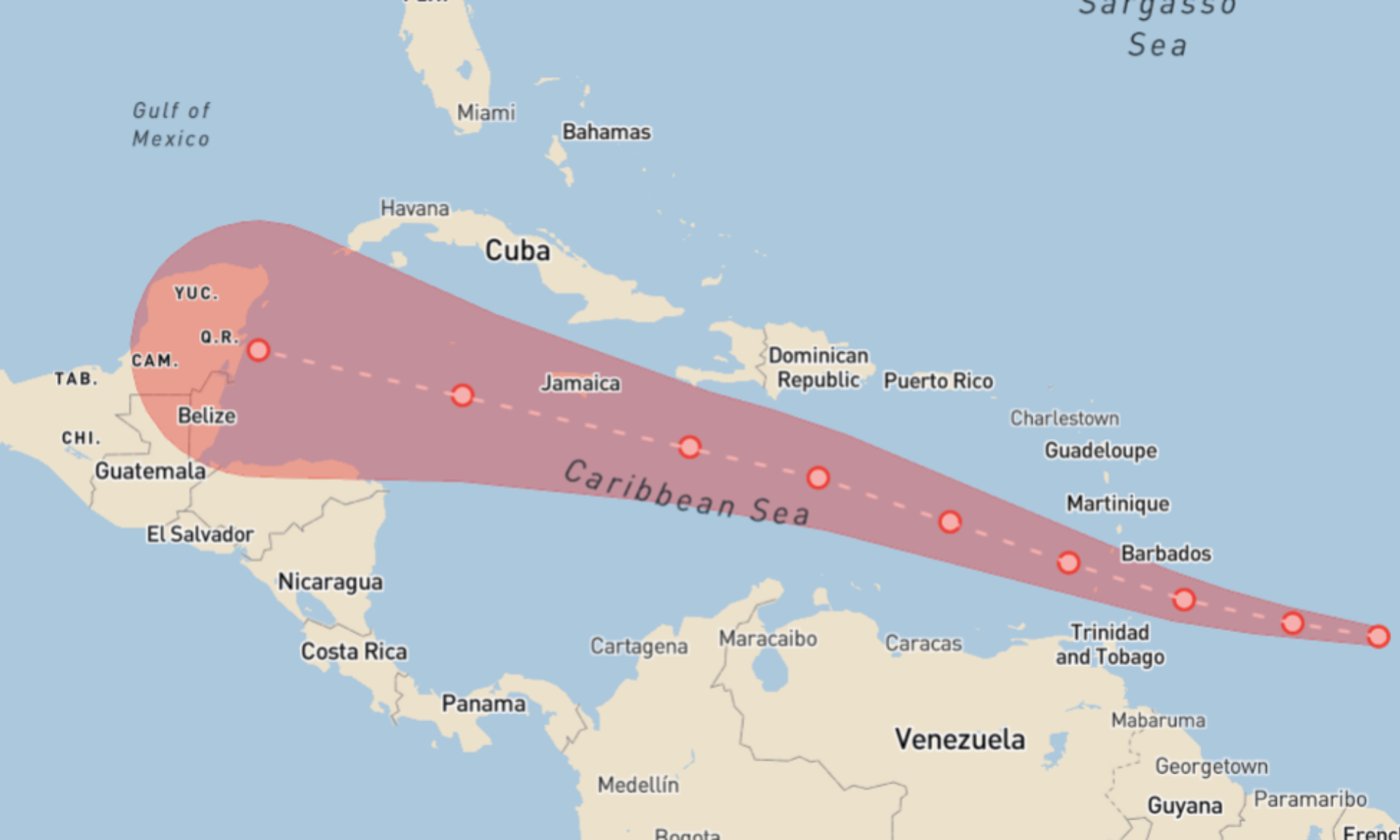
HURRICANE BERYL BUILDING LEVEL DAMAGE ASSESSMENTS 1 - 04/07
.png)
HURRICANE BERYL BUILDING LEVEL DAMAGE ASSESSMENTS 3 - 12/07
.png)
HURRICANE BERYL END OF REPORT - 16/07
.png)
HURRICANE DEBBY PRE-EVENT REPORT 1 AND PRE-EXPOSURE LAYER - 05/08
A quiet few weeks were followed by the emergence of Hurricane Debby, which saw the team respond with an initial Predicted Storm Surge layer. This event would see no more significant updates, except for further pre-event information, such as the Cone of Uncertainty.
.png)
HURRICANE ERNESTO PRE-EVENT REPORT 1 - 13/08
.png)
HURRICANE ERNESTO END OF REPORT - 18/08
.png)
HURRICANE FRANCINE PRE-EVENT REPORT 1 - 10/09
.png)
HURRICANE FRANCINE EXPOSURE LAYER 1 - 12/09
.png)
HURRICANE FRANCINE END OF REPORT - 18/09
With a final update to the Flood Exposure Layer, expanding coverage of New Orleans, the team's response to Francine was finished.
.png)
HURRICANE HELENE PRE-EVENT REPORT 1 - 24/09
.png)
HURRICANE JOHN EXPOSURE LAYER AND END OF REPORT - 24/09
.png)
HURRICANE HELENE GROUND LEVEL IMAGERY - 02/10
9 days into the MIS response to Helene, which had already seen the release of Wind and Flood Claims Grids, 7.5cm Aerial Imagery and 15cm Aerial Imagery, the first instance of Ground Level Imagery for Perry, Madison and Valdosta was added to the GEO report.
.png)
HURRICANE HELENE 15CM AERIAL IMAGERY (NORTH CAROLINA) - 07/10
As fallout from Helene continued, the team expanded their data collection activities and subsequently updated the event report with 15cm Aerial Imagery of affected areas in Asheville, North Carolina.
.png)
HURRICANE MILTON PRE-EVENT REPORT 1 - 07/10
.png)
HURRICANE HELENE INITIAL END OF REPORT - 12/10
As nearly 3 weeks of responding to Helene reached its initial conclusion, the team added final updates to the Flood Exposure and Claims Layer for North Carolina.
.png)
HURRICANE MILTON 15CM AERIAL IMAGERY - 12/10
.png)
HURRICANE MILTON GROUND LEVEL IMAGERY - 18/10
.png)
HURRICANE MILTON END OF REPORT - 29/10
Following over 3 weeks of the MIS team responding to Hurricane Milton, the end of the GEO report was marked with final updates to the Wind Claims and Exposure Layer, as well as the last release of 15cm Aerial Imagery and 50cm Satellite Imagery.
.png)
HURRICANE HELENE BUILDING LEVEL DAMAGE ASSESSMENTS - 18/11
.png)
.png?width=300&name=misgeo.io_(High%20Res%20Screenshot).png)
LOGIN TO GEO TO ACCESS MIS INTELLIGENCE FOR:
Hurricane Beryl
Hurricane Debby
Hurricane Ernesto
Hurricane Francine
Hurricane Helene
Hurricane John
Hurricane Milton
EVENT GALLERY
-
AERIAL IMAGES
-
GROUND IMAGES
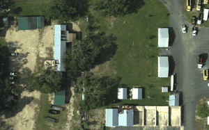
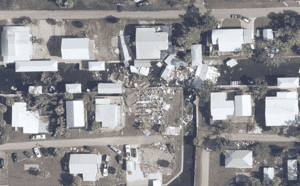
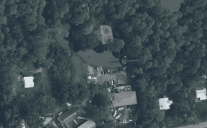
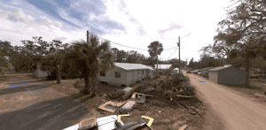



MIS 2024 ATLANTIC HURRICANE SEASON RESPONSE AVAILABLE ON GEO
Don't have a access to GEO? Request a demo below or for immediate support, contact mail@mckenzeintelligence.com


